Abstract
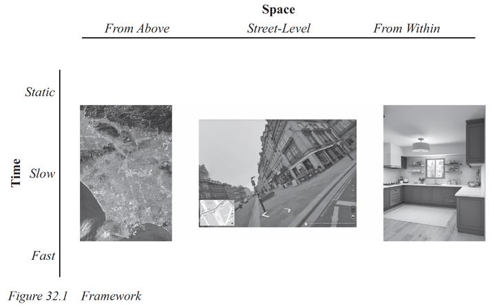
This chapter provides an overview of imagery data available and relevant for Regional Scientists. We present a general framework to understand imagery data, and illustrated it with a (non-comprehensive) review of applications in each category. Our framework is organised around two dimensions, space and time, and each dimension includes three scales. We divide imagery spatial based on the perspective from which the data is collected from above, at street-level, and from within. Similarly, we consider three main temporal scales - static, slow, and fast. The intersection of these two dimensions results in nine categories with distinct characteristics, degree of engagement from Regional Science, and potential for the near future. We discuss these with an illustration of existing applications, and conclude the chapter with a reflection on the potential impact of these data sources in the future of Regional Science.
Francisco Rowe
Professor of Population Data Science
My research interests include human mobility and migration; economic geography and spatial inequality; geographic data science.