Abstract
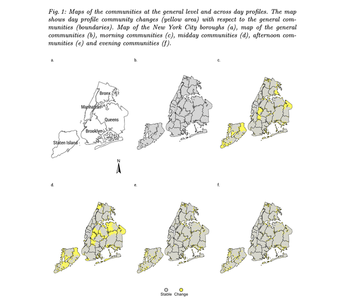
This paper leverages on the opportunities presented by individual level GPS data to study human mobility. It develops a methodology to understand the spatio-temporal properties of collective movements using network science. Through a spatially-weighted community detection approach, we derived functional neighbourhoods from human mobility patterns from GPS data and analyse the extent to which they vary across time. The results show that while the overall city structure remains stable, functional neighbourhoods tend to contract and expand over the course of the day. This work proposes a methodological framework and emphasises the importance of detecting short-term structural changes in cities based on human mobility.
Francisco Rowe
Professor of Population Data Science
My research interests include human mobility and migration; economic geography and spatial inequality; geographic data science.