Abstract
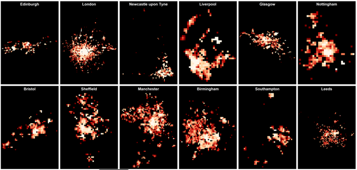
Current planning strategies promoting suburbanisation, land use zoning and low built-up density areas tend to increase the environmental footprint of cities. In the last decades, international and local government plans are increasingly targeted at making urban areas more sustainable. Urban structure has been proved to be an important factor guiding urban smart growth policies that promote sustainable urban environments and improve neighbourhood social cohesion. This paper draws on a series of unique historical datasets obtained from Ordnance Survey, covering the largest British urban areas over the last 15 years (2001-2016) to develop a set of twelve indicators and a composite Sustainable Urban Development Index to quantitatively measure and assess key built environment features and their relative change compared to other areas at each point in time based on regular 1 km2 grids. The results show that there is a relative increase in urban structure sustainability of areas in and around city centres and identify that the primary built environment feature driving these improvements was an increase in walkable spaces.
Francisco Rowe
Professor of Population Data Science
My research interests include human mobility and migration; economic geography and spatial inequality; geographic data science.