Project

Satellite imagery over city

IMAGO

Making satellite imagery useful, usable and used across social research and policy.

Project website

Data visualisation map

DEBIAS

Developing methods to measure and correct biases in digital-footprint mobility data.

Project website

Social health research poster

Social Health Hub

Social determinants of severe mental illness and place-based pathways for intervention.

Research hub page

Human mobility network graphic

UN Mobile Phone Data Task Team

Methods, standards and practice for responsible mobile phone data use in official statistics.

Task team page

Social media sentiment project image

Migration Sentiment, Digital Technology and AI

Measures migration attitudes from social media using theory-informed AI methods.
Maps spatial and network dynamics of anti-immigration discourse over time.
Builds scalable multilingual LLM pipelines for policy-relevant monitoring.

Project description

Population trend map

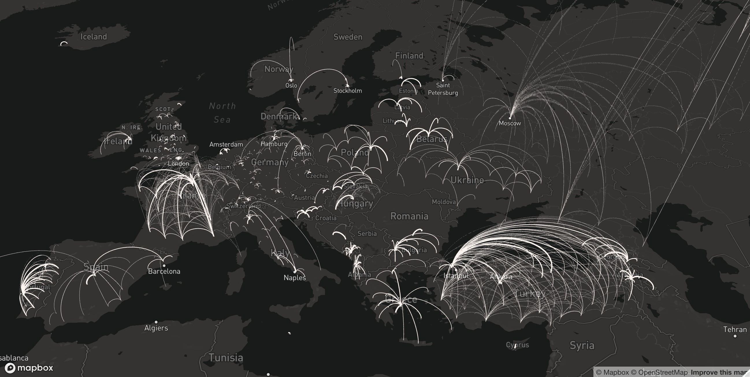
Human Mobility and Hazards

Tracks how climate extremes, conflict and epidemics disrupt mobility systems.
Combines digital trace data with demographic baselines for near-real-time inference.
Develops bias-corrected, policy-ready evidence for humanitarian and planning decisions.

Project description